หากใครเคยต้องการทำภาพ 3D บริเวณใด บริเวณหนึ่ง คงต้องปวดหัวแน่นอน กับการต้องเตรียม ทั้งภาพ ดาวเทียม Dem software ซึ่งส่วนมากที่เราใช้กัน คือ Software Arcscene ของค่าย ESRI แต่ทำออกมาแล้วก็ไม่สวยงาม วันนี้เลยใช้ความสามารถ ของ Google Earth ในการทำภาพ 3D
โดย software ที่ต้องใช้คือ Maptiler Download ที่ http://www.maptiler.org/ และ Google Earth
วิธีการคือ นำภาพ ที่ต้องการทำ 3D มาทำ tile image เพื่อนำไปแสดงผลบน google earth
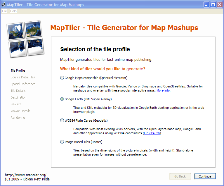
เปิด software Maptiler เลือก Google Earth (KML Super overlay) เสร็จแล้ว Continue
เลือกภาพ Add Continue
เลือกระบบพิกัด Continue
เลือกระดับการสร้างPyramid Continue
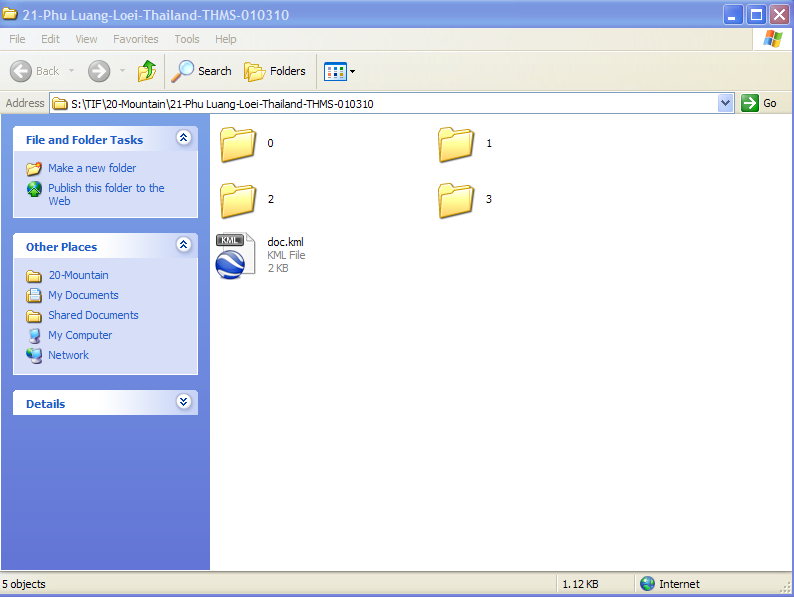
เลือกที่เก็บ file Continue ไปเรื่อยๆ จนถึง Render
เมื่อ render เสร็จเรียบร้อยแล้ว ให้เปิด folder ที่เก็บ file จะเจอ file doc.kml Double-click เพื่อเปิดด้วย google earth
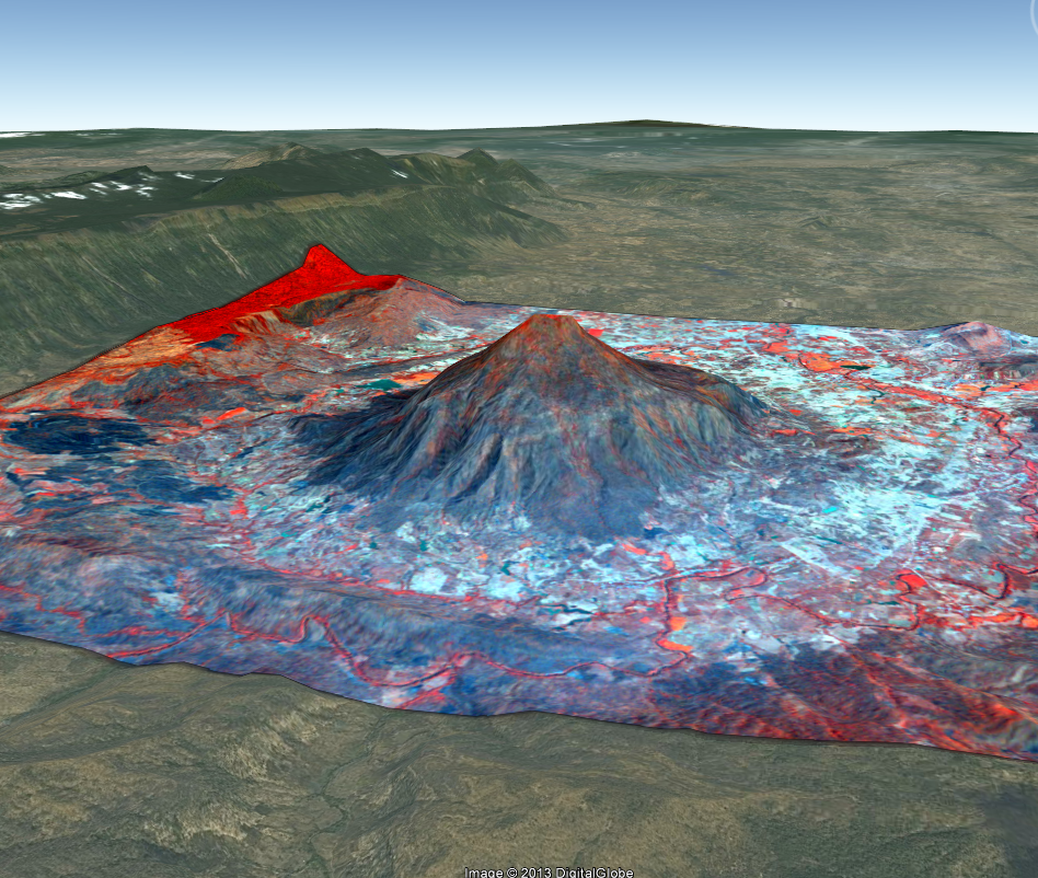
capture หน้าจอเพื่อนำไปใช้งานต่อไป
ข้อดีคือ มีภาพพื้นที่บริเวณอื่นๆ ติดอยู่ในภาพด้วย ไม่เหมือน Arcscene ที่มีภาพเฉพาะบริเวณที่ทำ 3D เท่านั้น
ที่มา : geo2ass.wordpress.com