การนำเข้าค่าพิกัดสู่เครื่อง GPS ครั้งนี้จะอธิบายการนำเข้าจาก 2 โปรแกรม ได้แก่ DNR Garmin และ Quantum GIS
1. ใช้โปรแกรม DNR Garmin
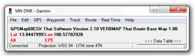
- 1 เมื่อเชื่อมต่อเครื่อง GPS เข้ากับโปรแกรม DNR Garmin จะปรากฏค่าพิกัดขึ้นมา
1.2 จากนั้นให้นำเข้าค่าพิกัด โดยคลิกที่ File –> Load from –> File
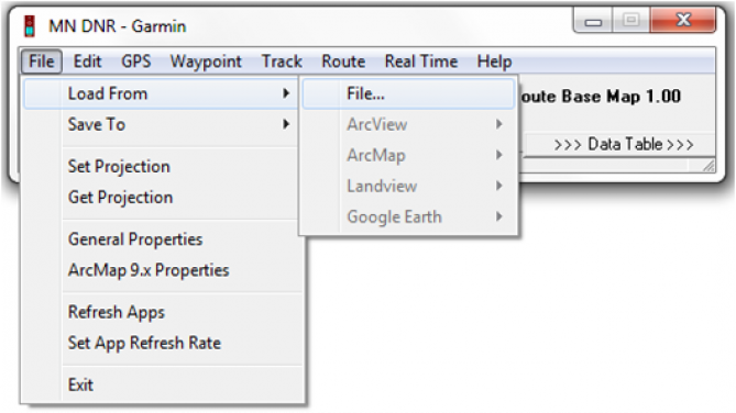
1.3 ชนิดของไฟล์ที่สามารถนำเข้าได้ ได้แก่
- Shapefile (.shp) ครั้งนี้จะเป็นการนำเข้าในรูปแบบนี้
- Dbase (.dbf)
- Text file (.txt)
- Google Earth Format (.kml)
- GPS eXchange Format (.gpx)
- Lowrance Export Text (.txt)

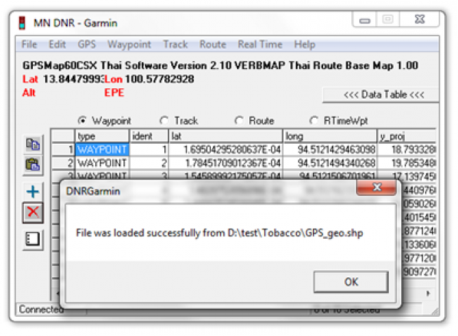
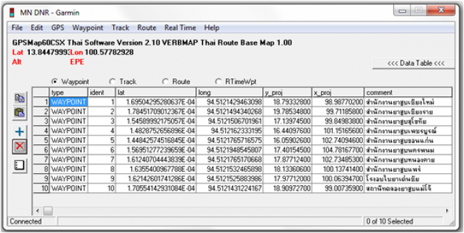
1.4 เมื่อนำเข้าข้อมูลเรียบร้อยแล้ว ตัวโปรแกรมจะสอบถามค่า Fields ที่ต้องการระบุ ให้เลือก Ident เป็น Sequential ID ส่วน Comment เลือก ช่อง Name แล้วคลิก OK ไฟล์ข้อมูลค่าพิกัดจะแสดงว่าดาวน์โหลดไฟล์สู่โปรแกรมสำเร็จ จำนวน 10 จุด ดังรูป

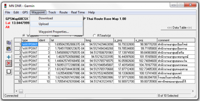
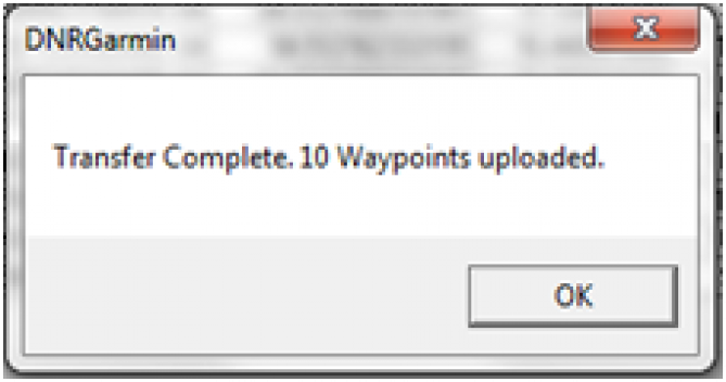
1.5 จากนั้นให้ทำการ Upload ไฟล์ค่าพิกัด จำนวน 10 จุด เข้าสู่เครื่อง GPS โดยไปที่เมนู Waypoint เลือก Upload
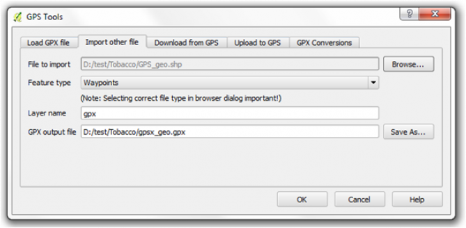
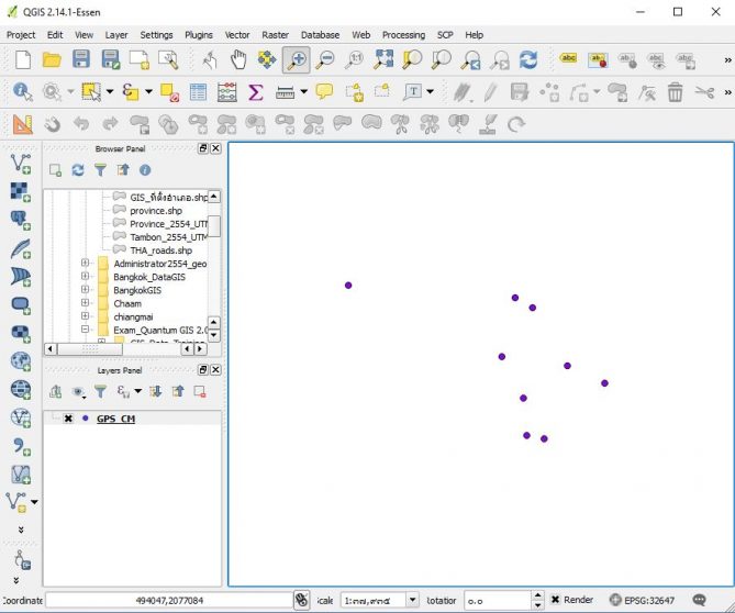
2. ใช้โปรแกรม Quantum GIS
2.1 ทำการดาวน์โหลดข้อมูลค่าพิกัด GPS เข้าสู่เครื่อง GPS โดยไปที่แถบเมนู Vector –> GPS –> GPS Tools

2.2 ไฟล์ที่สามารถนำเข้าได้จะต้องใช้เป็นนามสกุล .gpx